The Great Rift Valley, Kenya: A Journey Through Earth's Living Scar
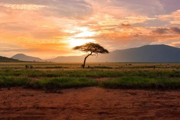
There are few places on the planet where geography feels this alive. Kenya's stretch of the Great Rift Valley is not a static postcard of hills and lakes, it is a landscape still being written by forces deep beneath the surface, a place where the earth is quite literally pulling itself apart a few millimetres at a time. For travellers, that translates into escarpment views that stop conversation mid sentence, lakes that turn pink with flamingos, volcanoes you can walk into, and towns whose entire rhythm of life has been shaped by the trench running through their backyard. This is a guide to understanding that valley, from the tectonic forces that carved it to the towns, viewpoints, wildlife, and changes defining it today, and what the coming decades might hold.
How the Valley Was Formed
The story begins around twenty five to thirty million years ago, during the late Oligocene and early Miocene epochs, when the African continental plate started to tear in two. The Nubian Plate to the west and the Somali Plate to the east began drifting apart, stretching and thinning the crust above them. As that crust thinned, it grew weak enough for magma to rise beneath it, triggering volcanic activity and eventually causing entire blocks of land to sink between parallel fault lines, a process geologists call rifting. The result is a valley with the classic architecture of a continental rift, steep escarpment walls on either side and a relatively flat, down dropped floor in between, dotted with the volcanic cones that fed the whole process.
This is part of the wider East African Rift System, a network of rift branches running roughly six thousand kilometres from the Afar Triangle in Ethiopia down through Kenya, Tanzania, and beyond into Mozambique. Kenya sits almost exactly in the middle of the Eastern branch, and the rift here has produced two of Africa's most recognisable peaks nearby, Mount Kenya and Mount Kilimanjaro, along with a chain of smaller volcanoes strung along the valley floor itself. The rifting is not finished. Movement continues today at a rate of roughly one to a few centimetres a year, slow by human standards but relentless on a geological one, and it is this ongoing activity that gives the valley its restless character, its geysers, its hot springs, and its earthquakes.
The valley also holds a special place in the story of humanity. Its ancient lakebeds and volcanic ash layers have preserved an extraordinary fossil record, and sites within the Kenyan rift, including Olorgesailie southwest of Nairobi, have yielded some of the most important evidence of early human tool use and evolution anywhere on Earth. Walking this ground means walking through both deep geological time and the earliest chapters of our own species.
The Towns That Call the Valley Home
Roughly ten million people live within Kenya's Rift Valley region, and the towns strung along its floor and escarpments each carry their own character. Nakuru, the valley's largest urban centre and Kenya's fourth biggest city, sits beside the lake that shares its name and functions as the region's transport and industrial hub, a gateway most visitors pass through en route to the lakes and parks further west. Naivasha, closer to Nairobi and perched on the shore of its namesake freshwater lake, has grown rapidly around flower farming, tourism, and geothermal industry, and today serves as the most common overnight base for exploring Hell's Gate and Lake Naivasha.
Further north, Nyahururu sits at a cooler, higher elevation near Thomson's Falls, while Eldoret, a major city on the valley's western edge, pulses with the energy of markets, agriculture, and Kenya's celebrated distance running culture, home to many of the Kalenjin athletes who dominate global track and field. Kericho, tucked into the highlands west of the rift, is blanketed in the lush green rows of tea plantations that supply much of the world's tea, offering a cooler, wetter counterpoint to the valley floor's dry heat. Smaller towns like Gilgil, Molo, Njoro, and Marigat round out a region that is at once agricultural, industrial, and deeply rural, home to a rich mix of communities including the Kalenjin and Maasai peoples, each with their own long relationship to this land.
Where to See It: The Valley's Best Viewpoints
No visit to the Kenyan Rift Valley is complete without standing at one of its escarpment viewpoints, and the most famous sits along the old Nairobi to Naivasha road, often simply called the Great Rift Valley Viewpoint or the Kinangop viewpoint. From here the high Nairobi plateau ends abruptly and the valley floor drops away for what feels like an eternity, with the matching wall of the Mau Escarpment visible across the void and Mount Longonot's jagged crater rising to the south. It remains one of the most photographed spots in the country and a favourite stop for travellers heading toward Naivasha or Nakuru.
Along the same road, smaller viewpoints such as Rukuma Escarpment and a handful of roadside lookouts offer similar sweeping panoramas, best visited at sunrise or sunset when the light turns the valley gold. For those willing to travel further, the Kerio Valley near Iten in western Kenya offers what many consider the single most dramatic escarpment view in the country, a steep, layered drop into a valley famous as the training ground of Kenya's world beating runners, though it demands a five to six hour drive from Nairobi and sees far fewer visitors than the more accessible spots near Naivasha.
Wildlife, Lakes, and National Parks
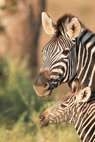
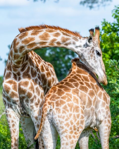
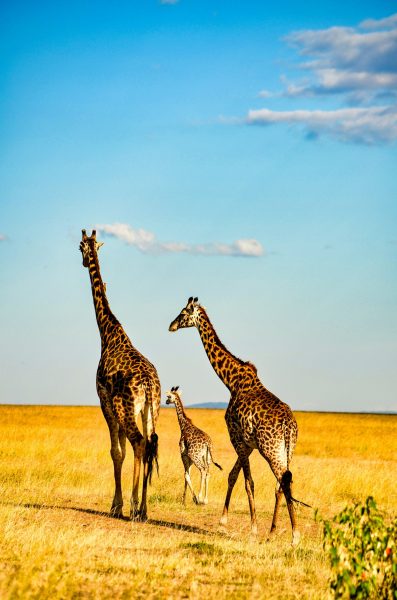
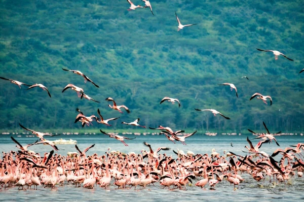
The valley floor is strung with a chain of lakes that together form one of Kenya's richest wildlife circuits. Most are alkaline soda lakes, their high mineral content feeding the algae and cyanobacteria that draw enormous flocks of lesser flamingos, while a handful of freshwater lakes support an entirely different cast of species. Lake Naivasha, one of the few freshwater lakes in the chain, is ringed by acacia woodland and hosts hippos, fish eagles, and boat safaris past floating pelicans, while neighbouring Crescent Island lets visitors walk on foot among giraffes, zebras, and antelope with no predators in sight. Just south of the lake, Hell's Gate National Park is one of only two parks in Kenya where visitors can hike, cycle, or rock climb freely without a vehicle, its landscape of obsidian cliffs, volcanic towers, and steaming vents so striking it helped inspire the animated landscapes of The Lion King.
Lake Nakuru National Park, a short drive south, is famous for its dense wildlife viewing in a compact area, home to both black and white rhino, giraffe, lion, and, depending on water chemistry in a given year, spectacular flamingo gatherings along its shores. Further north, Lake Bogoria and Lake Baringo form a striking pair, one boiling with geysers and hot springs, the other calm and freshwater, rich in birdlife and hippo pods. Rounding out the chain, Lake Magadi to the south is one of the most extreme soda lakes on Earth, and Lake Elmenteita offers a quieter, less visited flamingo spectacle between Naivasha and Nakuru. Above the lakes, dormant volcanoes add another dimension to the valley's appeal. Mount Longonot, an accessible stratovolcano near Naivasha, rewards a two to three hour hike with a full crater rim walk, while Menengai Crater near Nakuru ranks among the largest calderas on Earth, roughly twelve kilometres wide and hundreds of metres deep, and Mount Suswa further south hides lava tubes and caves worth exploring with a guide.
The Valley's Length and What's Changing Today
Kenya's segment of the Rift Valley stretches for roughly five to six hundred kilometres north to south through the country, a small but geologically vivid slice of the six thousand kilometre system that runs the length of eastern Africa from Lebanon to Mozambique. Within that stretch, change is happening on two very different timelines at once. On one hand, the valley's geothermal potential is being harnessed at a scale few other countries can match. Kenya now generates more than forty percent of its national electricity from geothermal sources, the highest share of any country in the world, and as of early 2026 the country had passed one thousand megawatts of installed geothermal capacity, ranking it among the world's leading geothermal producers. The Olkaria complex within Hell's Gate National Park remains the centrepiece of that effort, joined by newer projects at Menengai and a fresh Chinese built facility that came online in March 2026, with long term estimates suggesting the valley could ultimately support up to ten thousand megawatts of geothermal capacity.
On the other hand, the same rainfall variability reshaping East Africa's climate has sent water levels surging across several Rift Valley lakes over the past decade and a half, with Lake Naivasha, Lake Nakuru, Lake Baringo, and Lake Bogoria all expanding well beyond their historic shorelines, submerging farmland, roads, and lodges in the process. Heavy flooding has struck the wider region repeatedly in recent years, including severe rains in early 2026 that caused loss of life and displacement across several counties, underscoring how directly the valley's communities feel the effects of a changing climate.
What the Future Might Hold
Geologists are confident about where the Rift Valley is ultimately headed, even if the timeline stretches far beyond any human lifetime. The African continent is slowly but steadily splitting in two along this line, and scientists broadly agree that, given enough time, likely several million years, the rift will widen enough for the Indian Ocean to flood in, separating a new landmass, sometimes informally called the Nubian and Somali plates, from the rest of Africa and creating what would eventually become a new ocean basin. For anyone visiting today, that process is utterly imperceptible, but it is a genuinely humbling thought to stand at a viewpoint knowing the ground beneath your feet is drifting apart in real time.
In the nearer term, expect two parallel stories to keep shaping the valley. Energy development will almost certainly keep accelerating, with Kenya's government targeting well over 1,600 megawatts of geothermal capacity under its long term development plans and continuing to position the Rift Valley as a model for how volcanic geology can be turned into clean, reliable power for the wider region. At the same time, the valley's lakes and communities will likely keep grappling with the consequences of rising water levels and increasingly erratic rainfall, a challenge that will shape infrastructure planning, conservation strategy, and even where new lodges and tourism developments can safely be built. For tourism specifically, the outlook remains strongly positive. The valley's combination of accessible wildlife, dramatic scenery, and proximity to Nairobi means demand is likely to keep growing, particularly for shorter, lower cost getaways to Naivasha and Nakuru that pair easily with a longer safari itinerary elsewhere in the country. The lakes may keep shifting shape and the escarpments may keep drifting apart by fractions of a millimetre each year, but the Great Rift Valley's pull on travellers, much like the tectonic forces that built it, shows no sign of slowing down.